 SPECIALITA’ REGIONALI
 Caffè
Caffè Confetture, Marmellate
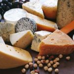 Formaggi
 Miele, Prodotti Apicoltura
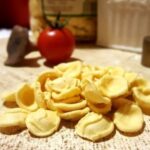 Pasta fresca e secca
 Prodotti da Forno
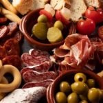
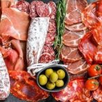 Salumi, Prosciutti
 Sottoli, Sottaceti
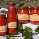 Pesto, Sughi, Patè, Creme spalmabili, Condimenti
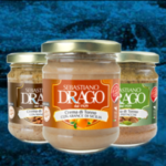 Tonno & pesce


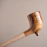 A. AMBROSI – PIPE ARTIGIANALI IN LEGNO
 PERLE DI PIA – GIOIELLI IN CERAMICA
 Bracciali
 Collane
 Orecchini
 Parure
 R. VERRI – SCULTURE IN PIETRA LECCESE
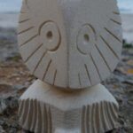 Animali in pietra leccese
 Lampade in pietra leccese
 PITTURA
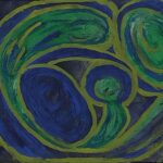 Raffa – Amore, Maternità, Famiglia
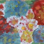 Raffa – Fiori & Alberi
 Raffa – Occhi
 Raffa – Temi vari
 SABRINA – Pittrice
 STAMPE DI FOTO E QUADRI
 RAFFA – Stampa di quadri
 ALESSA – Foto Dolomiti
 ALESSA- Foto Germania
 DOCUMENTARI VIDEO
 Agriturismo
Apulia / Orography
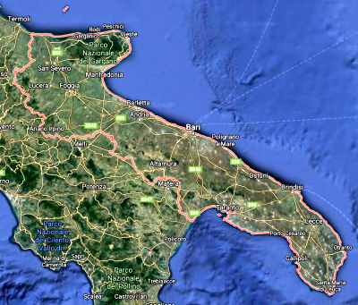
Orography of Apulia
Apulia is the easternmost region of Italy. The coasts (800 km) are sometimes rocky, sometimes they have sheer walls or are sandy. 98% of the Apulian coasts are suitable for swimming.
Orography of Puglia: General data
- Borders: Puglia borders the Molise Region to the north-west, the Campania and Basilicata regions to the west, the Adriatic Sea to the east and north, the Ionian Sea to the south.
- Area: 19,540.90 Km2
- Plains (53%): the Tavoliere, to the north, is the largest plain
- Hills (45%): constitute the Murgia Plateau, which extends, in the internal part, from north to south up to Brindisi
Mountains (2%): Gargano and Subappennino Dauno - Coasts (800 Km): sometimes rocky, sometimes they have sheer walls or are sandy; 98% of the Apulian coasts are suitable for swimming
- Islands: the Tremiti Archipelago, north-east of the Gargano peninsula; the small Cheradi islands, near Taranto; the islet of Sant’Andrea in front of the coast of Gallipoli.
See the page
Discover Apulia
See all the pages of APULIA
Click on “Apulia” at the bottom of the page
See the page
Regions of Italy
Enrich the content of this page with your contributions. Send your images and videos:
you will get fabulous discounts on your purchases in ItalyExcell stores.